-
Partager cette page
Distribution of arsenic concentrations in soils historically impacted by mining activities: Cross-validation of pXRF methodology and application to the Orbiel valley (France)
Co-signé Magali PHILIPPE & Jean Marc ANTOINE
Ce travail a été réalisé dans le cadre du projet « DiagnOSE » (« Diagnostic territorial spécifique dans le cas du bassin versant de l'Orbiel (Aude, Occitanie), territoire à haut risque socio-environnemental suite aux activités minières dans un climat de type méditerranéen »), financé en partie par la région Occitanie Pyrénées-Méditerranée, France, et géré par Toulouse INP. Cette étude n'aurait pas pu être menée sans l'aide précieuse des communautés locales pendant la campagne de terrain.
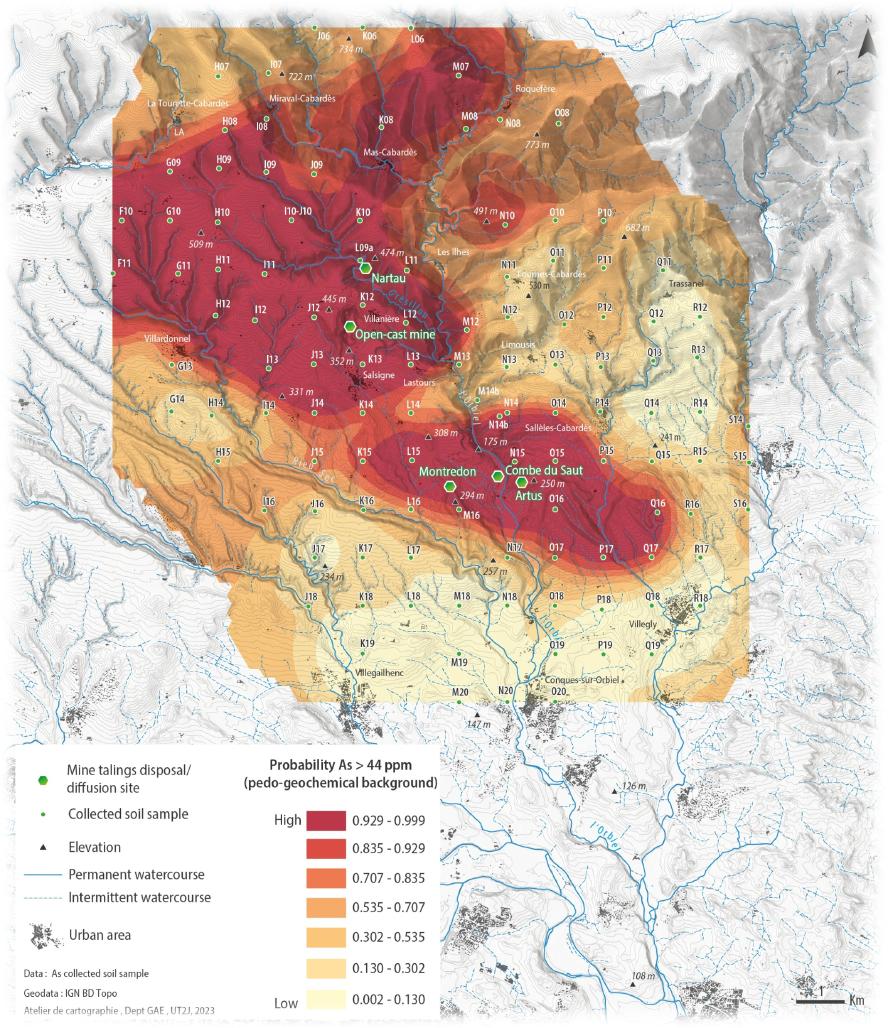
Understanding contaminant distribution in industrial and mining areas is essential for protecting human health and the environment, although traditional mapping methods are costly and time-consuming. This study aims to provide, using portable X-ray fluorescence (pXRF), rigorous maps of soil As concentrations over the Orbiel valley, historically impacted by mining activities since several decades. After a cross-calibration of pXRF with ICP-MS, we mapped As distribution in topsoils, and investigated factors influencing As dispersion.
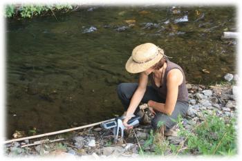
Two field campaigns were conducted: one targeting riverbanks and floodplains, the other on a 1 x 1 km grid over a 10 km radius from pollution sources. Spatial mapping identified three zones with high As concentrations (193–342 mg kg-1), exceeding background levels (44 mg kg-1), with floodplains particularly impacted (178 mg kg-1), likely due to transport processes.
Our findings confirm pXRF as a powerful tool for rapid, high-resolution As contamination screening in post-mining contexts. Cross-calibration showed no significant differences between pXRF and ICP-MS (Kruskal-Wallis, p > 0.05) and strong correlations (Pearson R > 0.90). Optimal pXRF modes (Soil, TestAllGeo and Mining modes) ensured accurate measurements of As, Pb, Mn, and Zn.
Finally, the maps of As distribution over the valley, as well as Pb isotopic data in the different environmental compartments, suggest both a local origin of this contamination and the influence of rivers but above all atmosphere in As dispersion.