


-
Partager cette page
Antoine LAURENT
Research EngineerContact details
- Address
- Maison de la Recherche, Jean Jaurès University 5, Allées A. Machado – 31058 TOULOUSE Cedex 1
- antoine.laurent@univ-tlse2.fr
Taught academic discipline(s)
GIS, DEM and 3D for the GAED Master’s programme
Research topics
My research focuses on the development and integration of 3D analysis and visualization tools in archaeology. The study materials range from the territory to the finest engravings, including the archaeological site itself.
As part of a PhD conducted between the IRIT and TRACES laboratories, and drawing on current photogrammetric digitization practices in archaeology and on the Alicia‑Vision LabCom, I aim to combine geometric and photometric 3D reconstruction techniques to achieve a level of 3D precision and resolution suitable for heritage studies.
These research themes apply to all remains of human activity, from the Paleolithic to the Modern period.
Activities / Resume
- Ongoing work :
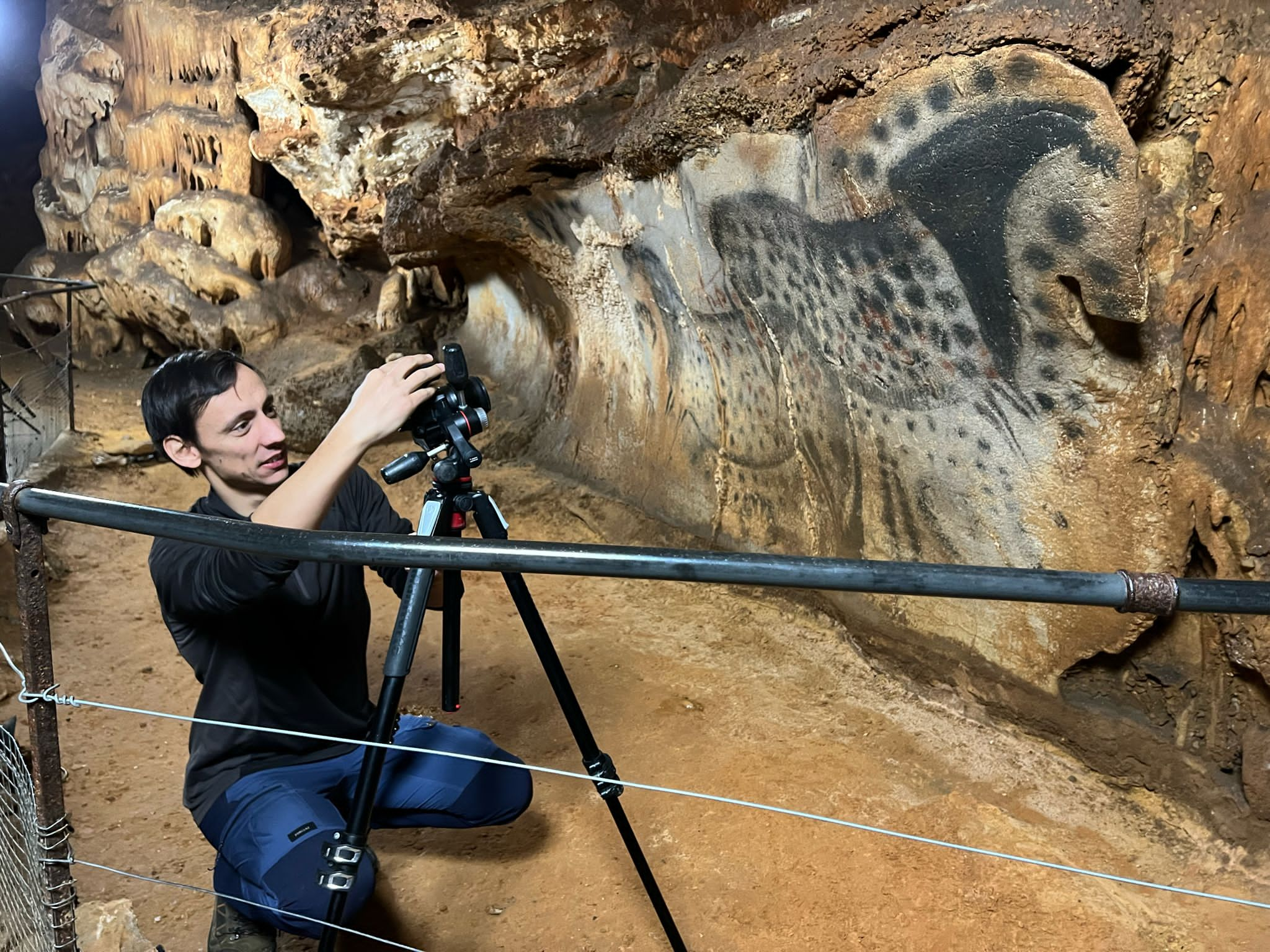
- Since 2019, integrated into the research team of the Chauvet–Pont‑d’Arc cave directed by Carole Fritz.
- Since 2019, integrated into the TAHMM programme team directed by Carine Calastrenc.
- Since 2017, participates in the survey and test‑pit activities of CERAC – Archéopole.
- Since 2016, integrated into Vincent Ard’s research team on his various PCR projects and the ANR Monumen.
- Since 2016, integrated into the research team of the ANR Archeostraits directed by Pierre Moret.
- Field operations in 2021 :
- Irissarry (64): Cave and shelters (dir. P. Marticorena): topography and 3D acquisition.
- Aurignac (31): Paleolithic site (dir. M. Lejay): 3D acquisition.
- Dolmens (49, 79, 85, 86): Dolmens (dir. V. Ard): topography and 3D acquisition.
- St‑Léger (86): Neolithic enclosure (dir. V. Ard): excavation, topography and 3D acquisition.
- Charmé (16): Neolithic enclosures (dir. V. Ard): excavation, topography and 3D acquisition.
- Grand‑Madieu (16): Geophysical survey (dir. G. Dandurand): topography and 3D acquisition.
- Bonneville (16): Neolithic enclosure (dir. C. Maitay): topography and 3D acquisition.
- Le Bernard (85): Dolmen and menhirs (dir. V. Ard): topography and 3D acquisition.
- Gréalou (46): Dolmen (dir. V. Ard): topography and 3D acquisition.
- Labruguière (81): Modern bastion (dir. S. Foucher): excavation and 3D acquisition.
- Chauvet Cave (07): Decorated cave (dir. C. Fritz): 3D acquisition.
Full CV on Huma‑Num in PDF : https://bit.ly/3nEFyoq